Satellite analysis,
without the GIS
overhead.
GeoClass turns multi-spectral Earth observation data into verifiable land cover classifications, canopy vitality indices, and microwave radar diagnostics. Define your boundary, compute in the cloud, and extract actionable spatial proof.
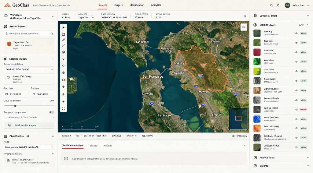
From coordinates to classified truth.
Four execution steps engineered for zero-friction spatial discovery. No desktop GIS installation, no dependency management, no satellite data harvesting required.
Define study area
Draw freeform polygons directly on satellite feeds or import shapefiles, KML, and GeoJSON vectors up to 2,500 km².
Select sensor array
Fuse Sentinel-2 MSI optical bands, Sentinel-1 SAR C-band radar, and Copernicus 30m digital elevation topography.
Run cloud machine learning
Execute Random Forest and spatial U-Net contextual models on Google Earth Engine cloud clusters in seconds.
Audit and export
Inspect confusion matrices, biophysical pixel curves, and export 32-bit GeoTIFF, GeoJSON, or publication dossiers.
Field-calibrated remote sensing physics.
GeoClass avoids decorative abstractions. Every metric is computed directly from physical electromagnetic reflectance, radar backscatter coefficients, and topographic elevation models.
10-Band Spectral Reflectance Graph
Click any coordinate to sample calibrated bottom-of-atmosphere surface reflectance from Coastal Blue (443nm) through Red Edge to SWIR-2 (2190nm). Distinguish iron oxide signatures from healthy chlorophyll.
Multi-Year Pixel Trajectory & LandTrendr
Chart harmonic temporal trajectories across a 5-year satellite record. Separate seasonal crop growth cycles from permanent deforestation, illegal mining expansion, and urban land conversions.
Sentinel-1 SAR Cloud Penetration
Active synthetic aperture radar emits microwave pulses that ignore equatorial cloud cover and atmospheric smoke. Monitor surface roughness, soil moisture, and hydrological flooding year-round.
Synchronized satellite layers.
Authentic raster composites computed on Google Earth Engine supercomputing clusters inside GeoClass.


Ready for QGIS, ArcGIS, and executive review.
Every raster layer, classification mask, and statistical chart can be downloaded in standard geospatial formats. Deliver verifiable spatial proofs directly into enterprise GIS workflows.
Initialize your survey terminal.
Access real-time Earth observation data for any coordinate on Earth. Launch the workspace now to delineate your study area.